Colorado Attractions & Outdoor Things to Do

Please click on the images below for more information on that activity.

Click Here for Hiking Tour Outfitters

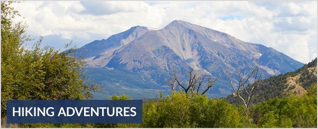
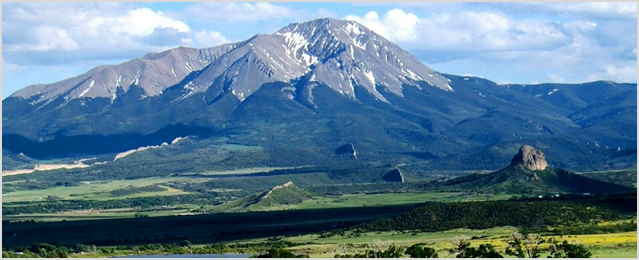
 Hiking Guide to trails and mountains in Colorado, Breckenridge, & Frisco

Hiking the trails and mountains of Colorado gives you the opportunity to escape the sounds of the city and focus on the beauty of the Rocky Mountains.

The three most important rules for Colorado mountain and trail hiking:

Start early because thunderstorms tend to roll in post-lunch, bringing with them lightning, hail and even in the summer months snow.

Bring healthy snacks and plenty of water. Hiking Colorado trails and mountains demands energy even the easy trails (remember you are at elevations of over 9,000 feet) stay fueled and hydrated

Wear several layers when mountain and trail hiking in Colorado because mountain weather changes in a flash, can go from an 80-degree sunny day to a snowstorm in a matter of minutes (seriously, pack a hat and gloves) It is easier to take layers off then to be cold, be prepared.

hiking content img

Hiking in Breckenridge & Frisco

Click Below for our recommended Outfitters that includes:

Easy hikes from Breckenridge:

  • Hoosier Pass Loop:
    Head south on US Hwy 9 from Breckenridge to the top of Hoosier Pass and park at the Continental Divide, there is a sign on the right side of the road. This three-mile loop is a photographer’s dream which offers an alpine experience without having to get your breath to and beyond tree line.
  • Spruce Creek Loop:
    Drive south on US Hwy 9 from Breckenridge for about 2.5 miles and turn right onto Spruce Creek Road. Look for a trailhead at about 1.2 miles. This is also a popular cross-country ski trail in the winter, the Spruce Creek loop is an easy four miles of trail through a beautiful pine forest that offers stunning views of the surrounding mountains.
  • Carter Park:
    This hike heads out of Carter Park, located in downtown Breckenridge, at 300 S. High St. You probably won’t work up a sweat, not really a hike, but your heart will skip a beat at the views as you climb up the stone steps from Carter Park. You’ll see the entire Ten Mile Range which encompasses Peak One to Peak 10 and the Breckenridge Ski Resort. Carter Park is also a great playground for the kids.
  • Sawmill Trail:
    Start by heading to the Snowflake Lift, near the intersection of Four O’clock Road and Kings Crown Road. This cool and shaded out-and- back covers about one and a half miles. The hike follows the stream at the base of the lift to a reservoir.
  • Burro Trail:
    The trail starts at the bottom of the Lehman Ski Trail which is at the base of Peak 9 off Village Road in town. This trail gives you access to a range of hiking options. Either pair it with a separate loop, or follow it out for as long as you wish. You don’t need to go far to feel like you’ve gotten away from everything. This is a very nice walk in the woods.

Moderate hikes from Breckenridge:

  • Black Powder Pass:
    This is 3.4 miles roundtrip with an elevation gain of 677 feet. Take Boreas Pass Road (at the south end of Breckenridge) up to the top of Boreas Pass, which is about 9 miles south. The trail begins just before the Section House, an older building that is easily visible once you get to the top of the pass. This is another hike that treats you to stunning, above tree-line scenery. In recent years, the hike has become better marked, which has given more hikers the chance to enjoy it. Most of the trail is manageable, with only a few tricky spots to traverse. The high altitude, especially those spots over 12,000 feet, may give you a chance to catch your breath. As you progress, you’ll be able to see Quandary Peak, Mt. Baldy, and an amazing stretch of the Ten Mile Range. The wildflowers are especially plentiful in July and August.
  • Peaks Trail:
    This hike is 8.5 miles one-way with an elevation gain of 1,285 feet. Take Highway 9 to Ski Hill Road. Go to the top of Ski Hill Road, just past the peak 8 base area, turn right. You’ll pass the Grand Timber Lodge and the trailhead will be on your left. This trail goes from Breckenridge to Frisco and gives you a wonderful perspective of all the mountain scenery that exists between these two towns. There are amazing views of the Ten Mile Range, plus the trail travels by Rainbow Lake in Frisco. You can stop in Frisco to grab a bite to eat before heading back to Breckenridge. If you find that the hike to Frisco has worn you out, take the free bus back to Breckenridge. Or, if you really want a workout, hike the trail back. Going back to Breckenridge has many more uphill sections, so you’re sure to feel the burn.
  • Blue Lakes-Monte Cristo Gulch:
    Drive south on US Hwy 9 for eight miles to Blue Lakes Road (No. 850). Turn right and follow the road for 2.2 miles to the parking area just below the dam. The trail starts above tree line at 11,748 feet and in 2.5 miles takes you to an historic mining area surrounded by alpine lakes. Be prepared for jaw dropping views.
  • McCullough Gulch:
    From Breckenridge you head south on US Hwy 9 to Blue Lakes Road (No. 850). Turn right and then turn right again onto County road 851. Continue for two miles and park near the water diversion structures. Then you will walk to the trailhead, a 15-minute walk on a path which is left of a sign marked: “Private Road, No Admittance.” This 2.6-mile hike winds through pine forests, past waterfalls, meadows, and wildflowers. In other words, it’s Colorado.
  • Mohawk Lakes:
    You will head south from Breckenridge on US Hwy 9 to Spruce Creek Road (No. 800). Continue 1.2 miles to the trailhead. A perennial favorite (for a reason!), Mohawk Lakes is often referred to as an absolute must, here’s why: it’s a stunning five-mile hike that climbs to beautiful lakes and historic ruins. Its equal parts challenging and do-able for the whole family.
  • Quandary Peak:
    Drive south on US Hwy 9 to Blue Lakes Road (no. 850), turn right, and then turn right onto County Road 851 for 0.1 miles to the Quandary Peak trailhead. This is one of Colorado’s 54 14ers (peaks that reach in elevation above 14,000 feet), Quandary is a friendly but tough hike. Although only six miles, the trail climbs 3,305 feet in elevation, this will take anywhere from three to nine hours to complete, depending on fitness. Start early as weather can change very fast.
  • Wheeler National Recreation Trail:
    You’ll need two cars to shuttle this long (10 miles) hike. Park one at the trailhead off of County Road 851 south of town. Park the other at the Vail Pass/Ten Mile Canyon Bikeway Parking Area. The logistical and athletic effort is well worth it for this long and challenging trail that crosses the Ten Mile Range at nearly 12,500 feet. Here too, be prepared for weather changes.

Frisco Hikes:

  • Eccles Pass:
    This is 9.5 miles and vertical 2800 ft. Take I-70 going west. Drive I-70 west to Frisco exit 203. As you exit onto the traffic circle, take the dirt road that leaves the circle on the west side and parallels the interstate. Parking and the trailhead are about a half mile down this dirt road. This is a tough challenging hike that consists of a fairly steady, steep climb to the pass at 11,900′ that will reward you with some of the most beautiful scenery in Colorado. As you proceed along the rushing of Meadow Creek through the forest, the trail levels off frequently enough to provide brief breaks from the climb! After a couple miles you enter a clearing dotted with mining ruins, which are fun to see and the valley is pretty serene. Follow the trail and climb even higher to reach Eccles Pass and you will be rewarded with spectacular views of Buffalo Mountain and the surrounding area. Even though this is a difficult hike it is worth the views and solitude.
  • Lily Pad Lake Trail:
    This is a 5 mile trail, with just 700 vertical ft. Take I-70 going west. Drive I-70 west to Frisco exit 203. As you exit onto the traffic circle, take the dirt road that leaves the circle on the west side and parallels the interstate. Parking and the trailhead are about a half mile down this road. The Lily Pad Lake Trail promises a delightful day hike for every hiker. Because the lake is located in the Eagle’s Nest Wilderness, bicycles are not permitted here, a refreshing change for a trail located close to an urban area. Don’t let the first 100-yard climb up the access road near the Wilderness subdivision discourage little hikers.
  • Meadow Creek Trail:
    This is 9 miles and vertical 700 ft. Take I-70 going west to Frisco exit 203. As you exit onto the traffic circle, take the dirt road that leaves the circle on the west side and parallels the interstate. Parking and the trailhead are about a half mile down this road. While warm in July and August, this is a great early and late season hike or as a “tune- up” for more challenging treks later. The trail begins with a steady hike for about half of a mile to a junction with the Lily Pad Trail. Take the Lily Pad Trail (on your right) and soon you will be treated to the sights and sounds of Meadow Creek, a footbridge, and great views of Frisco, and Lake Dillon. As you continue the ascent the views keep getting better! Also, look for Peak One as it rises above Mt. Royal and Mt. Victoria to the south. Soon, the trail leaves the creek and ascends a small rise leading to the first of two lakes. Follow the trail between the two lakes around the second lake on your right (north). Continue for a half mile on the trail past the second lake (really just a small pond covered with lilies) to the junction with the Salt Lick Trail. Here the trail begins its descent into Salt Lick Gulch, or you can loop back around to your car in Frisco.
  • Rainbow Lake:
    This is easy 1 mile and very little vertical. Take I-70 west to Frisco exit 203 and follow Summit Blvd-CO 9 over the interstate. Then turn right onto Main Street; park at the Frisco Park-n- Ride at the end of Frisco Main Street near Hwy I-70. Take the paved bike path to the Mt. Royal trailhead. Rainbow Lake is the perfect hike for the whole family. Enjoy a well-marked trail through the woods, over bridges and streams. Make sure you bring a picnic and fishing rod for this is a delightful place to relax and enjoy your day. The views of the valley are gorgeous and Rainbow Lake is amazing in the twilight of the summer.
  • Mount Royal:
    It is 3.8 miles and 1330 of vertical. The trail to Masontown is a pleasant family hike. A side trip to the east of town can provide fun exploring the area for mining relics. The hike from Masontown to Mount Royal and farther up to the ridge of Mount Victoria is strenuous but passes more mine and cabin ruins. The upward grunt is worth the climb for the views, especially the straight-down, birds-eye view of Interstate 70 in Ten Mile Canyon. Limber pine, which grows in harsh conditions, live on the ridges. Four different hikes along these trails make the area well worth exploring during several visits. While walking along the paved recreational path toward the Mount Royal Trail, imagine the sounds of the old trains which steamed along here. Two railroads served Frisco. The first, the Denver & Rio Grande (D&RG), came from Leadville down Ten Mile Canyon, arriving in town in summer 1882. The Denver, South Park & Pacific, later called the Colorado & Southern (C&S), choo-choo and chugged down the recreational path from Breckenridge arriving in Frisco in July 1883. At mile 0.3 the depot for the C&S once stood. Across the field you can see the tailings from the Frisco Tunnel, which operated into the 1930s.

Click Here for Hiking Tour Outfitters

About CMA

We are dedicated to finding the best outfitters and guide companies along with other local Colorado services.

Read More

facebook instagram pinterest twitter