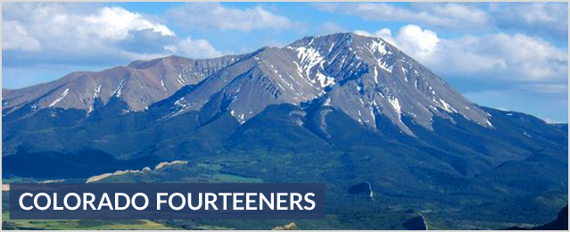
What is a fourteener? A peak that rises 14,000 feet or more above sea level. Colorado is home to more of these than any other state. (Alaska has 22; California has 12; Washington has 1) There are 58 fourteeners in Colorado and a select club that has ascended all of them.
*** In the descriptions below please note there are other ascent routes that are more difficult, google the Colorado fourteener you are planning to hike for additional information.
Exposure ratings:
0 – No exposure on the trail & the terrain is gentle
1 – Mild exposure in the vicinity
2 – Mild exposure close proximity to the trail
3 – Moderate exposure close to the trail, could be avoidable with slow hiking
4 – Serious exposure very dangerous if you fell, routes are more technical
5 – Dangerous exposure requires technical experience, big drops
6 – Vertical exposure very technical, requires roped climbing route
Colorado Fourteeners Mountain Climbing & Hiking Guide
-
Mt. Elbert 14,433’ Sawatch Range
- Mt. Elbert
- Rank: 1 of 53
- Elevation: 14,433'
- Range: Sawatch
- Counties:
- Towns: Leadville, Twin Lakes and Aspen
-
Mt. Massive 14,421’ Sawatch Range
- Difficulty: Class 2
- Exposure: Mild exposure very close to the route. Route options may be limited but you should be able to walk past the exposure area.
- Trailhead: Mt. Massive
- Start: 10,080 feet
- Summit: 14,421 feet
- Total Gain: 4,500 feet
- RT Length: 14.50 miles
-
Mt. Harvard 14,420’ Sawatch Range
- Difficulty: Class 2
- Ski: Intermediate
- Exposure: Mild exposure very close to the route. Route options may be limited but you should be able to walk past the exposure area.
- Trailhead: N. Cottonwood Creek
- Start: 9,900 feet
- Summit: 14,420 feet
- Total Gain: 4,600 feet
-
Blanca Peak 14,345’ Sangre de Cristo
- Difficulty: Class 1
- Exposure: No exposure in the area. Gentle terrain.
- Trailhead: Lake Como (Blanca Peak)
- Start: 8,000 feet
- Upper Elevation: 11,750 feet
- Total Gain: 3,900 feet
- RT Length: 11.00 miles
-
La Plata Peak 14,336’ Sawatch Range
- Difficulty: Class 2
- Exposure: Mild exposure very close to the route. Route options may be limited but you should be able to walk past the exposure area.
- Trailhead: La Plata Peak
- Start: 10,000 feet
- Summit: 14,336 feet
- Total Gain: 4,500 feet
- RT Length: 9.25 miles
-
Uncompahgre Peak 14,309’ San Juan Mountains
- Difficulty: Class 2
- Ski: Intermediate
- Exposure: Mild exposure very close to the route. Route options may be limited but you should be able to walk past the exposure area.
- Trailhead: Nellie Creek
- Start: 11,400 feet
- Summit: 14,309 feet
- Total Gain: 3,000 feet
- 5,505 feet starting at 2WD TH (9,350')
- RT Length: 7.25 miles - 15.25 miles starting at 2WD TH (9,350')
-
Crestone Peak 14,294’ Sangre de Cristo
- Difficulty: Class 3
- Exposure: More serious exposure that could result in serious injury or death if you fell. Moving past the area will require some scrambling or short technical moves.
- Trailhead: South Colony Lakes
- Start: 9,900 feet
- Summit: 14,197 feet
- Total Gain: 4,400 feet starting at upper 4wd TH (9,900)
- 5,550 feet starting at lower 2wd TH (8,800)
- RT Length: 12 miles starting at upper 4wd TH (9,900)
- 18 miles starting at lower 2wd TH (8,800)
-
Mt. Lincoln 14,286’ Mosquito Range
- Difficulty: Class 2
- Exposure: Mild exposure in the area but not along the immediate route.
- Trailhead: Kite Lake New
- Start: 12,000 feet
- Summit: 14,286 feet
- Total Gain: 2,600 feet
- RT Length: 6.00 miles
-
Grays Peak 14,270’ Front Range
- Difficulty: Class 1
- Ski: Intermediate,
- Exposure: Mild exposure in the area but not along the immediate route.
- Trailhead: Grays Peak New
- Start: 11,280 feet
- Summit: 14,270 feet
- Total Gain: 3,000 feet
-
Mt. Antero 14,269’ Sawatch Range
- Difficulty: Class 2
- Exposure: Mild exposure very close to the route. Route options may be limited but you should be able to walk past the exposure area.
- Trailhead: Baldwin Gulch
- Start: 9,400 feet
- Summit: 14,269 feet
- Total Gain: 5,200 feet from the 2WD trailhead
- 2,400 feet if you drive a 4WD to 12,000'
- RT Length: 16 miles from the 2WD trailhead - 7 miles if you drive a 4WD to 12,000’
-
Torreys Peak 14,267’ Front Range
- Difficulty: Class 2
- Ski: Intermediate,
- Exposure: Mild exposure in the area but not along the immediate route.
- Trailhead: Grays Peak
- Start: 11,280 feet
- Summit: 14,267 feet
- Total Gain: 3,000 feet
- RT Length: 8.00 miles
-
Castle Peak 14,265’ Elk Mountains
- Difficulty: Difficult Class 2
- Exposure: Moderate exposure along the immediate route. It should be avoidable with some slow hiking or scrambling.
- Trailhead: Castle Creek
- Start: 9,800 feet
- Summit: 14,265 feet
- Total Gain: 4,600' if you start at the main trailhead 3,100 feet if you start at 11,200'
- RT Length:13.5 miles if you start at the main trailhead
7 miles if you start hiking from 11,200'
-
Quandary Peak 14,265’ Tenmile Range
- Difficulty: Class 1
- Ski: Intermediate,
- Exposure: Mild exposure in the area but not along the immediate route.
- Trailhead: Quandary New
- Start: 10,850 feet
- Summit: 14,265 feet
- Total Gain: 3,450 feet
- RT Length: 6.75 miles
-
Mt. Evans 14,264’ Front Range
- Difficulty: Class 2
- Exposure: Mild exposure very close to the route. Route options may be limited but you should be able to walk past the exposure area.
- Trailhead: Echo Lake
- Start: 10,650 feet
- Summit: 14,264 feet
- Total Gain: 5,600 feet
- RT Length: 16.5 - 17.5 miles
-
Longs Peak 14,255’ Front Range
- Difficulty: Class 3
- Exposure: More serious exposure that could result in serious injury or death if you fell. Moving past the area will require some scrambling or short technical moves.
- Trailhead: Longs Peak
- Start: 9,400 feet
- Summit: 14,255 feet
- Total Gain: 5,300 feet
- RT Length: 13 miles
-
Mt. Wilson 14,246’ San Juan Mountains
- Difficulty: Class 1
- Exposure: Mild exposure in the area but not along the immediate route.
- Trailhead: Navajo Lake
- Start: 9,350 feet
- Upper Elevation: 13,000 feet
- Total Gain: 2,000' - 3,700'
- RT Length: Navajo Lake: 9.5 miles RT
- Upper Navajo Basin: 12 - 14 miles RT
-
Mt. Shavano 14,229’ Sawatch Range
- Difficulty: Class 2
- Ski: Intermediate,
- Exposure: Mild exposure very close to the route. Route options may be limited but you should be able to walk past the exposure area.
- Trailhead: Shavano/Tabeguache New
- Start: 9,750 feet
- Summit: 14,229 feet
- Total Gain: 4,600 feet
- RT Length: 9.25 miles
-
Mt. Belford 14,197’ Sawatch Range
- Difficulty: Class 2
- Ski: Intermediate,
- Exposure: Mild exposure in the area but not along the immediate route.
- Trailhead: Missouri Gulch
- Start: 9,650 feet
- Summit: 14,197 feet
- Total Gain: 4,500 feet
- RT Length: 8.00 miles
-
Crestone Needle 14,197’ Sangre de Cristo
- Difficulty: Class 3
- Exposure: More serious exposure that could result in serious injury or death if you fell. Moving past the area will require some scrambling or short technical moves.
- Trailhead: South Colony Lakes New
- Start: 9,900 feet
- Summit: 14,197 feet
- Total Gain: 4,400 feet starting at upper 4wd TH (9,900) 5,550 feet starting at lower 2wd TH (8,800)
- RT Length: 12 miles starting at upper 4wd TH (9,900) 18 miles starting at lower 2wd TH (8,800)
-
Mt. Princeton 14,197’ Sawatch Range
- Difficulty: Class 2
- Ski: Advanced,
- Exposure: Mild exposure very close to the route. Route options may be limited but you should be able to walk past the exposure area.
- Trailhead: Mt. Princeton Road New
- Start: 8,900 feet
- Summit: 14,197 feet
- Total Gain: 5,400' if you start at the main trailhead (8,900')3,200' if you start near 11,000' on the road
- RT Length: 13.25 miles if you start at the main trailhead (8,900') 6.5 miles if you start near 11,000' on the road
-
Mt. Yale 14,196’ Sawatch Range
- Difficulty: Class 2
- Exposure: Mild exposure very close to the route. Route options may be limited but you should be able to walk past the exposure area.
- Trailhead: Denny Creek
- Start: 9,900 feet
- Summit: 14,196 feet
- Total Gain: 4,300 feet
- RT Length: 9.50 miles
-
Mt. Bross 14,172’ Mosquito Range
- Difficulty: Class 1
- Ski: Novice,
- Exposure: Mild exposure in the area but not along the immediate route.
- Trailhead: Mineral Park
- Start: 11,400 feet
- Summit: 14,172 feet
- Total Gain: 2,900 feet
- RT Length: 9.00 miles
-
Kit Carson Peak 14,165’ Sangre de Cristo
- Difficulty: Class 1
- Exposure: Mild exposure in the area but not along the immediate route.
- Trailhead: Willow Creek
- Start: 8,850 feet
- Upper Elevation: 11,564 feet
- Total Gain: 2,850 feet
- RT Length: 9.50 miles
* El Diente Peak 14,159’ San Juan Mountains
- Difficulty: Class 1
- Exposure: Mild exposure in the area but not along the immediate route.
- Trailhead: Navajo Lake
- Start: 9,350 feet
- Upper Elevation: 13,000 feet
- Total Gain: 2,000' - 3,700'
- RT Length: Navajo Lake: 9.5 miles RT
- Upper Navajo Basin: 12 - 14 miles RT
-
Maroon Peak 14,156’ Elk Mountains
- Difficulty: Class 3
- Exposure: More serious exposure that could result in serious injury or death if you fell. Moving past the area will require some scrambling or short technical moves.
- Trailhead: Maroon Lake
- Start: 9,590 feet
- Summit: 14,156 feet
- Total Gain: 4,800 feet
- RT Length: 11.50 miles
-
Tabeguache Peak 14,155’ Sawatch Range
- Difficulty: Class 2
- Ski: Intermediate,
- Exposure: Mild exposure very close to the route. Route options may be limited but you should be able to walk past the exposure area.
- Trailhead: Shavano/Tabeguache New
- Start: 9,750 feet
- Summit: 14,229 feet
- Total Gain: 4,600 feet
- RT Length: 9.25 miles
-
Mt. Oxford 14,153’ Sawatch Range
- Difficulty: Class 2
- Ski: Intermediate,
- Exposure: Mild exposure in the area but not along the immediate route.
- Trailhead: Missouri Gulch
- Start: 9,650 feet
- Summit: 14,197 feet
- Total Gain: 4,500 feet
- RT Length: 8.00 miles
-
Mt. Sneffels 14,150’ San Juan Mountains
- Difficulty: Difficult Class 2
- Exposure: Moderate exposure along the immediate route. It should be avoidable with some slow hiking or scrambling.
- Trailhead: Yankee Boy Basin
- Start: 11,350 feet
- Summit: 14,150 feet
- Total Gain: 1,700 feet - starting at the upper trailhead (12,460') 2,900 feet - starting at restroom parking area (11,350')
- RT Length: 2.50 miles - starting at the upper trailhead (12,460') 6.00 miles - starting at restroom parking area (11,350')
-
Mt. Democrat 14,148’ Mosquito Range
- Difficulty: Class 2
- Ski: Intermediate,
- Exposure: Mild exposure in the area but not along the immediate route.
- Trailhead: Kite Lake
- Start: 12,000 feet
- Summit: 14,148 feet
- Total Gain: 2,150 feet
- RT Length: 4.00 miles
-
Capitol Peak 14,130’ Elk Mountains
- Difficulty: Class 4
- Exposure: Dangerous exposure that requires careful, technical moves to navigate around. A fall would likely be fatal. Big, sheer drops.
- Trailhead: Capitol Creek
- Start: 9,450 feet
- Summit: 14,130 feet
- Total Gain: 5,300 feet
- RT Length: 17.00 miles
-
Pikes Peak 14,110’ Front Range
- Difficulty: Class 2
- Exposure: Mild exposure in the area but not along the immediate route.
- Trailhead: Crags Campground New
- Start: 10,000 feet
- Summit: 14,110 feet
- Total Gain: 4,300 feet
- RT Length: 14.00 miles
-
Snowmass Mountain 14,092’ Elk Mountains
- Difficulty: Class 3
- Exposure: Moderate exposure along the immediate route. It should be avoidable with some slow hiking or scrambling.
- Trailhead: Snowmass Creek
- Start: 8,400 feet
- Summit: 14,092 feet
- Total Gain: 5,800 feet
- RT Length: 22.00 miles
-
Mt. Eolus 14,083’ San Juan Mountains
- Difficulty: Class 1
- Exposure: No exposure in the area. Gentle terrain.
- Trailhead: Needleton
- Start: 8,220 feet
- Upper Elevation: 11,000 feet
- Total Gain: 2,800 feet
- RT Length: 12.00 miles
-
Windom Peak 14,082’ San Juan Mountains
- Difficulty: Class 1
- Exposure: No exposure in the area. Gentle terrain.
- Trailhead: Needleton
- Start: 8,220 feet
- Upper Elevation: 11,000 feet
- Total Gain: 2,800 feet
- RT Length: 12.00 miles
-
Challenger Point 14,081’ Sangre de Cristo
- Difficulty: Class 1
- Exposure: Mild exposure in the area but not along the immediate route.
- Trailhead: Willow Creek
- Start: 8,850 feet
- Upper Elevation: 11,564 feet
- Total Gain: 2,850 feet
- RT Length: 9.50 miles
-
Mt. Columbia 14,073’ Sawatch Range
- Difficulty: Class 2
- Ski: Intermediate,
- Exposure: Mild exposure very close to the route. Route options may be limited but you should be able to walk past the exposure area.
- Trailhead: N. Cottonwood Creek
- Start: 9,900 feet
- Summit: 14,420 feet
- Total Gain: 4,600 feet
- RT Length: 14.00 miles
-
Missouri Mountain 14,067’ Sawatch Range
- Difficulty: Class 2
- Exposure: Moderate exposure along the immediate route. It should be avoidable with some slow hiking or scrambling.
- Trailhead: Missouri Gulch
- Start: 9,650 feet
- Summit: 14,067 feet
- Total Gain: 4,500 feet
- RT Length: 10.50 miles
-
Humboldt Peak 14,064’ Sangre de Cristo
- Difficulty: Class 2
- Exposure: Mild exposure very close to the route. Route options may be limited but you should be able to walk past the exposure area.
- Trailhead: South Colony Lakes New
- Start: 9,950 feet
- Summit: 14,064 feet
- Total Gain: 4,200 feet starting at upper 4wd TH (9,950)5,350 feet starting at lower 2wd TH (8,800)
- RT Length: 11.00 miles starting at upper 4wd TH (9,950)16.50 miles starting at lower 2wd TH (8,800)
-
Mt. Bierstadt 14,060’ Front Range
- Difficulty: Class 2
- Ski: Intermediate,
- Exposure: Mild exposure in the area but not along the immediate route.
- Trailhead: Guanella Pass
- Start: 11,669 feet
- Summit: 14,060 feet
- Total Gain: 2,850 feet
- RT Length: 7.00 miles
* Conundrum Peak 14,060’ Elk Mountains
- Difficulty: Difficult Class 2
- Exposure: Moderate exposure along the immediate route. It should be avoidable with some slow hiking or scrambling.
- Trailhead: Castle Creek
- Start: 9,800 feet
- Summit: 14,265 feet
- Total Gain: 4,600' if you start at the main trailhead 3,100 feet if you start at 11,200'
- RT Length: 13.5 miles if you start at the main trailhead 7 miles if you start hiking from 11,200'
-
Sunlight Peak 14,059’ San Juan Mountains
- Difficulty: Class 1
- Exposure: No exposure in the area. Gentle terrain.
- Trailhead: Needleton
- Start: 8,220 feet
- Upper Elevation: 11,000 feet
- Total Gain: 2,800 feet
- RT Length: 12.00 miles
-
Handies Peak 14,048’ San Juan Mountains
- Difficulty: Class 1
- Ski: Intermediate,
- Exposure: Mild exposure in the area but not along the immediate route.
- Trailhead: American Basin
- Start: 11,600 feet
- Summit: 14,048 feet
- Total Gain: 2,500 feet - 2,800 feet if you start at the bottom of the American Basin road
- RT Length: 5.5 miles - 7.5 miles if you start at the bottom of the American Basin road
-
Culebra Peak 14,047’ Sangre de Cristo
- Difficulty: Class 2
- Exposure: Mild exposure very close to the route. Route options may be limited but you should be able to walk past the exposure area.
- Trailhead: Culebra (Main)
- Start: 11,240 feet
- Summit: 14,047 feet
- Total Gain: 2,700 starting at 4WD trailhead - 3,150 starting at Four Way - 5,450 starting at ranch HQ building
- RT Length: 5 miles starting at 4WD trailhead - 7 miles starting at Four Way - 14 miles starting at ranch HQ building
-
Ellingwood Point 14,042’ Sangre de Cristo
- Difficulty: Class 1
- Exposure: No exposure in the area. Gentle terrain.
- Trailhead: Lake Como (Blanca Peak)
- Start: 8,000 feet
- Upper Elevation: 11,750 feet
- Total Gain: 3,900 feet
- RT Length: 11.00 miles
-
Mt. Lindsey 14,042’ Sangre de Cristo
- Difficulty: Difficult Class 2
- Exposure: Mild exposure very close to the route. Route options may be limited but you should be able to walk past the exposure area.
- Trailhead: Huerfano/Lily Lake
- Start: 10,700 feet
- Summit: 14,042 feet
- Total Gain: 3,500 feet
- RT Length: 8.25 miles
* North Eolus 14,039’ San Juan Mountains
- Difficulty: Class 1
- Exposure: No exposure in the area. Gentle terrain.
- Trailhead: Needleton
- Start: 8,220 feet
- Upper Elevation: 11,000 feet
- Total Gain: 2,800 feet
- RT Length: 12.00 miles
-
Little Bear Peak 14,037’ Sangre de Cristo
- Difficulty: Class 1
- Exposure: No exposure in the area. Gentle terrain.
- Trailhead: Lake Como (Blanca Peak)
- Start: 8,000 feet
- Upper Elevation: 11,750 feet
- Total Gain: 3,900 feet
- RT Length: 11.00 miles
-
Mt. Sherman 14,036’ Mosquito Range
- Difficulty: Class 2
- Exposure: Mild exposure very close to the route. Route options may be limited but you should be able to walk past the exposure area.
- Trailhead: Fourmile Creek New
- Start: 12,000 feet
- Summit: 14,036 feet
- Total Gain: 2,100' starting at the 12,000-foot gate - 2,850' starting near 11,250' (Leavick Site) on the road - 3,100' starting at the normal winter closure near 11,100'
- RT Length: 5.25 miles starting at the 12,000-foot gate - 8.5 miles starting near 11,250' (Leavick Site) on the road - 10.5 miles starting at the normal winter closure near 11,100'
-
Redcloud Peak 14,034’ San Juan Mountains
- Difficulty: Class 2
- Ski: Intermediate,
- Exposure: Mild exposure very close to the route. Route options may be limited but you should be able to walk past the exposure area.
- Trailhead: Silver Crk/Grizzly Gulch New
- Start: 10,400 feet
- Summit: 14,034 feet
- Total Gain: 3,700 feet
- RT Length: 9.00 miles
-
Pyramid Peak 14,018’ Elk Mountains
- Difficulty: Class 4
- Exposure: More serious exposure that could result in serious injury or death if you fell. Moving past the area will require some scrambling or short technical moves.
- Trailhead: Maroon Lake
- Start: 9,600 feet
- Summit: 14,018 feet
- Total Gain: 4,500 feet
- RT Length: 8.25 miles
-
Wilson Peak 14,017’ San Juan Mountains
- Difficulty: Class 1
- Exposure: Mild exposure in the area but not along the immediate route.
- Trailhead: Navajo Lake
- Start: 9,350 feet
- Upper Elevation: 13,000 feet
- Total Gain: 2,000' - 3,700'
- RT Length: Navajo Lake: 9.5 miles RT
- Upper Navajo Basin: 12 - 14 miles RT
-
Wetterhorn Peak 14,015’ San Juan Mountains
- Difficulty: Class 1
- Exposure: Mild exposure in the area but not along the immediate route.
- Trailhead: Navajo Lake
- Start: 9,350 feet
- Upper Elevation: 13,000 feet
- Total Gain: 2,000' - 3,700'
- RT Length: Navajo Lake: 9.5 miles RT
- Upper Navajo Basin: 12 - 14 miles RT
-
San Luis Peak 14,014’ San Juan Mountains
- Difficulty: Class 1
- Ski: Intermediate, D4 / R2 / III
- Exposure: No exposure in the area. Gentle terrain.
- Trailhead: Stewart Creek
- Start: 10,500 feet
- Summit: 14,014 feet
- Total Gain: 3,600 feet
- RT Length: 13.50 miles
* North Maroon Peak 14,014’ Elk Mountains
- Difficulty: Class 3
- Exposure: More serious exposure that could result in serious injury or death if you fell. Moving past the area will require some scrambling or short technical moves.
- Trailhead: Maroon Lake
- Start: 9,590 feet
- Summit: 14,156 feet
- Total Gain: 4,800 feet
- RT Length: 11.50 miles
-
Mt. of the Holy Cross 14,005’ Sawatch Range
- Difficulty: Class 2
- Exposure: Mild exposure very close to the route. Route options may be limited but you should be able to walk past the exposure area.
- Trailhead: Half Moon (Tigiwon)
- Start: 10,320 feet
- Summit: 14,005 feet
- Total Gain: 5,600 feet
- RT Length: 12.00 miles
-
Huron Peak 14,003’ Sawatch Range
- Difficulty: Class 2
- Exposure: Mild exposure very close to the route. Route options may be limited but you should be able to walk past the exposure area.
- Trailhead: Clear Crk./S.Winfield New
- Start: 10,560 feet
- Summit: 14,003 feet
- Total Gain: 3,500 feet
- 3,800 feet if you hike the road from Winfield
- RT Length: 6.5 miles - 10.75 miles if you hike the road from Winfield
-
Sunshine Peak 14,001’ San Juan Mountains
- Difficulty: Class 2
- Ski: Intermediate,
- Exposure: Mild exposure very close to the route. Route options may be limited but you should be able to walk past the exposure area.
- Trailhead: Silver Crk/Grizzly Gulch New
- Start: 10,400 feet
- Summit: 14,034 feet
- Total Gain: 3,700 feet
- RT Length: 9.00 miles
-
Mt. Elbert 14,433’ Sawatch Range
- Mt. Elbert
- Rank: 1 of 53
- Elevation: 14,433'
- Range: Sawatch
- Counties:
- Towns: Leadville, Twin Lakes and Aspen
-
Mt. Massive 14,421’ Sawatch Range
- Difficulty: Class 2
- Exposure: Mild exposure very close to the route. Route options may be limited but you should be able to walk past the exposure area.
- Trailhead: Mt. Massive
- Start: 10,080 feet
- Summit: 14,421 feet
- Total Gain: 4,500 feet
- RT Length: 14.50 miles
-
Mt. Harvard 14,420’ Sawatch Range
- Difficulty: Class 2
- Ski: Intermediate
- Exposure: Mild exposure very close to the route. Route options may be limited but you should be able to walk past the exposure area.
- Trailhead: N. Cottonwood Creek
- Start: 9,900 feet
- Summit: 14,420 feet
- Total Gain: 4,600 feet
-
Blanca Peak 14,345’ Sangre de Cristo
- Difficulty: Class 1
- Exposure: No exposure in the area. Gentle terrain.
- Trailhead: Lake Como (Blanca Peak)
- Start: 8,000 feet
- Upper Elevation: 11,750 feet
- Total Gain: 3,900 feet
- RT Length: 11.00 miles
-
La Plata Peak 14,336’ Sawatch Range
- Difficulty: Class 2
- Exposure: Mild exposure very close to the route. Route options may be limited but you should be able to walk past the exposure area.
- Trailhead: La Plata Peak
- Start: 10,000 feet
- Summit: 14,336 feet
- Total Gain: 4,500 feet
- RT Length: 9.25 miles
-
Uncompahgre Peak 14,309’ San Juan Mountains
- Difficulty: Class 2
- Ski: Intermediate
- Exposure: Mild exposure very close to the route. Route options may be limited but you should be able to walk past the exposure area.
- Trailhead: Nellie Creek
- Start: 11,400 feet
- Summit: 14,309 feet
- Total Gain: 3,000 feet
- 5,505 feet starting at 2WD TH (9,350')
- RT Length: 7.25 miles - 15.25 miles starting at 2WD TH (9,350')
-
Crestone Peak 14,294’ Sangre de Cristo
- Difficulty: Class 3
- Exposure: More serious exposure that could result in serious injury or death if you fell. Moving past the area will require some scrambling or short technical moves.
- Trailhead: South Colony Lakes
- Start: 9,900 feet
- Summit: 14,197 feet
- Total Gain: 4,400 feet starting at upper 4wd TH (9,900)
- 5,550 feet starting at lower 2wd TH (8,800)
- RT Length: 12 miles starting at upper 4wd TH (9,900)
- 18 miles starting at lower 2wd TH (8,800)
-
Mt. Lincoln 14,286’ Mosquito Range
- Difficulty: Class 2
- Exposure: Mild exposure in the area but not along the immediate route.
- Trailhead: Kite Lake New
- Start: 12,000 feet
- Summit: 14,286 feet
- Total Gain: 2,600 feet
- RT Length: 6.00 miles
-
Grays Peak 14,270’ Front Range
- Difficulty: Class 1
- Ski: Intermediate,
- Exposure: Mild exposure in the area but not along the immediate route.
- Trailhead: Grays Peak New
- Start: 11,280 feet
- Summit: 14,270 feet
- Total Gain: 3,000 feet
-
Mt. Antero 14,269’ Sawatch Range
- Difficulty: Class 2
- Exposure: Mild exposure very close to the route. Route options may be limited but you should be able to walk past the exposure area.
- Trailhead: Baldwin Gulch
- Start: 9,400 feet
- Summit: 14,269 feet
- Total Gain: 5,200 feet from the 2WD trailhead
- 2,400 feet if you drive a 4WD to 12,000'
- RT Length: 16 miles from the 2WD trailhead - 7 miles if you drive a 4WD to 12,000’
-
Torreys Peak 14,267’ Front Range
- Difficulty: Class 2
- Ski: Intermediate,
- Exposure: Mild exposure in the area but not along the immediate route.
- Trailhead: Grays Peak
- Start: 11,280 feet
- Summit: 14,267 feet
- Total Gain: 3,000 feet
- RT Length: 8.00 miles
-
Castle Peak 14,265’ Elk Mountains
- Difficulty: Difficult Class 2
- Exposure: Moderate exposure along the immediate route. It should be avoidable with some slow hiking or scrambling.
- Trailhead: Castle Creek
- Start: 9,800 feet
- Summit: 14,265 feet
- Total Gain: 4,600' if you start at the main trailhead 3,100 feet if you start at 11,200'
- RT Length:13.5 miles if you start at the main trailhead 7 miles if you start hiking from 11,200'
-
Quandary Peak 14,265’ Tenmile Range
- Difficulty: Class 1
- Ski: Intermediate,
- Exposure: Mild exposure in the area but not along the immediate route.
- Trailhead: Quandary New
- Start: 10,850 feet
- Summit: 14,265 feet
- Total Gain: 3,450 feet
- RT Length: 6.75 miles
-
Mt. Evans 14,264’ Front Range
- Difficulty: Class 2
- Exposure: Mild exposure very close to the route. Route options may be limited but you should be able to walk past the exposure area.
- Trailhead: Echo Lake
- Start: 10,650 feet
- Summit: 14,264 feet
- Total Gain: 5,600 feet
- RT Length: 16.5 - 17.5 miles
-
Longs Peak 14,255’ Front Range
- Difficulty: Class 3
- Exposure: More serious exposure that could result in serious injury or death if you fell. Moving past the area will require some scrambling or short technical moves.
- Trailhead: Longs Peak
- Start: 9,400 feet
- Summit: 14,255 feet
- Total Gain: 5,300 feet
- RT Length: 13 miles
-
Mt. Wilson 14,246’ San Juan Mountains
- Difficulty: Class 1
- Exposure: Mild exposure in the area but not along the immediate route.
- Trailhead: Navajo Lake
- Start: 9,350 feet
- Upper Elevation: 13,000 feet
- Total Gain: 2,000' - 3,700'
- RT Length: Navajo Lake: 9.5 miles RT
- Upper Navajo Basin: 12 - 14 miles RT
-
Mt. Shavano 14,229’ Sawatch Range
- Difficulty: Class 2
- Ski: Intermediate,
- Exposure: Mild exposure very close to the route. Route options may be limited but you should be able to walk past the exposure area.
- Trailhead: Shavano/Tabeguache New
- Start: 9,750 feet
- Summit: 14,229 feet
- Total Gain: 4,600 feet
- RT Length: 9.25 miles
-
Mt. Belford 14,197’ Sawatch Range
- Difficulty: Class 2
- Ski: Intermediate,
- Exposure: Mild exposure in the area but not along the immediate route.
- Trailhead: Missouri Gulch
- Start: 9,650 feet
- Summit: 14,197 feet
- Total Gain: 4,500 feet
- RT Length: 8.00 miles
-
Crestone Needle 14,197’ Sangre de Cristo
- Difficulty: Class 3
- Exposure: More serious exposure that could result in serious injury or death if you fell. Moving past the area will require some scrambling or short technical moves.
- Trailhead: South Colony Lakes New
- Start: 9,900 feet
- Summit: 14,197 feet
- Total Gain: 4,400 feet starting at upper 4wd TH (9,900) 5,550 feet starting at lower 2wd TH (8,800)
- RT Length: 12 miles starting at upper 4wd TH (9,900) 18 miles starting at lower 2wd TH (8,800)
-
Mt. Princeton 14,197’ Sawatch Range
- Difficulty: Class 2
- Ski: Advanced,
- Exposure: Mild exposure very close to the route. Route options may be limited but you should be able to walk past the exposure area.
- Trailhead: Mt. Princeton Road New
- Start: 8,900 feet
- Summit: 14,197 feet
- Total Gain: 5,400' if you start at the main trailhead (8,900')3,200' if you start near 11,000' on the road
- RT Length: 13.25 miles if you start at the main trailhead (8,900') 6.5 miles if you start near 11,000' on the road
-
Mt. Yale 14,196’ Sawatch Range
- Difficulty: Class 2
- Exposure: Mild exposure very close to the route. Route options may be limited but you should be able to walk past the exposure area.
- Trailhead: Denny Creek
- Start: 9,900 feet
- Summit: 14,196 feet
- Total Gain: 4,300 feet
- RT Length: 9.50 miles
-
Mt. Bross 14,172’ Mosquito Range
- Difficulty: Class 1
- Ski: Novice,
- Exposure: Mild exposure in the area but not along the immediate route.
- Trailhead: Mineral Park
- Start: 11,400 feet
- Summit: 14,172 feet
- Total Gain: 2,900 feet
- RT Length: 9.00 miles
-
Kit Carson Peak 14,165’ Sangre de Cristo
- Difficulty: Class 1
- Exposure: Mild exposure in the area but not along the immediate route.
- Trailhead: Willow Creek
- Start: 8,850 feet
- Upper Elevation: 11,564 feet
- Total Gain: 2,850 feet
- RT Length: 9.50 miles
- Difficulty: Class 1
- Exposure: Mild exposure in the area but not along the immediate route.
- Trailhead: Navajo Lake
- Start: 9,350 feet
- Upper Elevation: 13,000 feet
- Total Gain: 2,000' - 3,700'
- RT Length: Navajo Lake: 9.5 miles RT
- Upper Navajo Basin: 12 - 14 miles RT
-
Maroon Peak 14,156’ Elk Mountains
- Difficulty: Class 3
- Exposure: More serious exposure that could result in serious injury or death if you fell. Moving past the area will require some scrambling or short technical moves.
- Trailhead: Maroon Lake
- Start: 9,590 feet
- Summit: 14,156 feet
- Total Gain: 4,800 feet
- RT Length: 11.50 miles
-
Tabeguache Peak 14,155’ Sawatch Range
- Difficulty: Class 2
- Ski: Intermediate,
- Exposure: Mild exposure very close to the route. Route options may be limited but you should be able to walk past the exposure area.
- Trailhead: Shavano/Tabeguache New
- Start: 9,750 feet
- Summit: 14,229 feet
- Total Gain: 4,600 feet
- RT Length: 9.25 miles
-
Mt. Oxford 14,153’ Sawatch Range
- Difficulty: Class 2
- Ski: Intermediate,
- Exposure: Mild exposure in the area but not along the immediate route.
- Trailhead: Missouri Gulch
- Start: 9,650 feet
- Summit: 14,197 feet
- Total Gain: 4,500 feet
- RT Length: 8.00 miles
-
Mt. Sneffels 14,150’ San Juan Mountains
- Difficulty: Difficult Class 2
- Exposure: Moderate exposure along the immediate route. It should be avoidable with some slow hiking or scrambling.
- Trailhead: Yankee Boy Basin
- Start: 11,350 feet
- Summit: 14,150 feet
- Total Gain: 1,700 feet - starting at the upper trailhead (12,460') 2,900 feet - starting at restroom parking area (11,350')
- RT Length: 2.50 miles - starting at the upper trailhead (12,460') 6.00 miles - starting at restroom parking area (11,350')
-
Mt. Democrat 14,148’ Mosquito Range
- Difficulty: Class 2
- Ski: Intermediate,
- Exposure: Mild exposure in the area but not along the immediate route.
- Trailhead: Kite Lake
- Start: 12,000 feet
- Summit: 14,148 feet
- Total Gain: 2,150 feet
- RT Length: 4.00 miles
-
Capitol Peak 14,130’ Elk Mountains
- Difficulty: Class 4
- Exposure: Dangerous exposure that requires careful, technical moves to navigate around. A fall would likely be fatal. Big, sheer drops.
- Trailhead: Capitol Creek
- Start: 9,450 feet
- Summit: 14,130 feet
- Total Gain: 5,300 feet
- RT Length: 17.00 miles
-
Pikes Peak 14,110’ Front Range
- Difficulty: Class 2
- Exposure: Mild exposure in the area but not along the immediate route.
- Trailhead: Crags Campground New
- Start: 10,000 feet
- Summit: 14,110 feet
- Total Gain: 4,300 feet
- RT Length: 14.00 miles
-
Snowmass Mountain 14,092’ Elk Mountains
- Difficulty: Class 3
- Exposure: Moderate exposure along the immediate route. It should be avoidable with some slow hiking or scrambling.
- Trailhead: Snowmass Creek
- Start: 8,400 feet
- Summit: 14,092 feet
- Total Gain: 5,800 feet
- RT Length: 22.00 miles
-
Mt. Eolus 14,083’ San Juan Mountains
- Difficulty: Class 1
- Exposure: No exposure in the area. Gentle terrain.
- Trailhead: Needleton
- Start: 8,220 feet
- Upper Elevation: 11,000 feet
- Total Gain: 2,800 feet
- RT Length: 12.00 miles
-
Windom Peak 14,082’ San Juan Mountains
- Difficulty: Class 1
- Exposure: No exposure in the area. Gentle terrain.
- Trailhead: Needleton
- Start: 8,220 feet
- Upper Elevation: 11,000 feet
- Total Gain: 2,800 feet
- RT Length: 12.00 miles
-
Challenger Point 14,081’ Sangre de Cristo
- Difficulty: Class 1
- Exposure: Mild exposure in the area but not along the immediate route.
- Trailhead: Willow Creek
- Start: 8,850 feet
- Upper Elevation: 11,564 feet
- Total Gain: 2,850 feet
- RT Length: 9.50 miles
-
Mt. Columbia 14,073’ Sawatch Range
- Difficulty: Class 2
- Ski: Intermediate,
- Exposure: Mild exposure very close to the route. Route options may be limited but you should be able to walk past the exposure area.
- Trailhead: N. Cottonwood Creek
- Start: 9,900 feet
- Summit: 14,420 feet
- Total Gain: 4,600 feet
- RT Length: 14.00 miles
-
Missouri Mountain 14,067’ Sawatch Range
- Difficulty: Class 2
- Exposure: Moderate exposure along the immediate route. It should be avoidable with some slow hiking or scrambling.
- Trailhead: Missouri Gulch
- Start: 9,650 feet
- Summit: 14,067 feet
- Total Gain: 4,500 feet
- RT Length: 10.50 miles
-
Humboldt Peak 14,064’ Sangre de Cristo
- Difficulty: Class 2
- Exposure: Mild exposure very close to the route. Route options may be limited but you should be able to walk past the exposure area.
- Trailhead: South Colony Lakes New
- Start: 9,950 feet
- Summit: 14,064 feet
- Total Gain: 4,200 feet starting at upper 4wd TH (9,950)5,350 feet starting at lower 2wd TH (8,800)
- RT Length: 11.00 miles starting at upper 4wd TH (9,950)16.50 miles starting at lower 2wd TH (8,800)
-
Mt. Bierstadt 14,060’ Front Range
- Difficulty: Class 2
- Ski: Intermediate,
- Exposure: Mild exposure in the area but not along the immediate route.
- Trailhead: Guanella Pass
- Start: 11,669 feet
- Summit: 14,060 feet
- Total Gain: 2,850 feet
- RT Length: 7.00 miles
- Difficulty: Difficult Class 2
- Exposure: Moderate exposure along the immediate route. It should be avoidable with some slow hiking or scrambling.
- Trailhead: Castle Creek
- Start: 9,800 feet
- Summit: 14,265 feet
- Total Gain: 4,600' if you start at the main trailhead 3,100 feet if you start at 11,200'
- RT Length: 13.5 miles if you start at the main trailhead 7 miles if you start hiking from 11,200'
-
Sunlight Peak 14,059’ San Juan Mountains
- Difficulty: Class 1
- Exposure: No exposure in the area. Gentle terrain.
- Trailhead: Needleton
- Start: 8,220 feet
- Upper Elevation: 11,000 feet
- Total Gain: 2,800 feet
- RT Length: 12.00 miles
-
Handies Peak 14,048’ San Juan Mountains
- Difficulty: Class 1
- Ski: Intermediate,
- Exposure: Mild exposure in the area but not along the immediate route.
- Trailhead: American Basin
- Start: 11,600 feet
- Summit: 14,048 feet
- Total Gain: 2,500 feet - 2,800 feet if you start at the bottom of the American Basin road
- RT Length: 5.5 miles - 7.5 miles if you start at the bottom of the American Basin road
-
Culebra Peak 14,047’ Sangre de Cristo
- Difficulty: Class 2
- Exposure: Mild exposure very close to the route. Route options may be limited but you should be able to walk past the exposure area.
- Trailhead: Culebra (Main)
- Start: 11,240 feet
- Summit: 14,047 feet
- Total Gain: 2,700 starting at 4WD trailhead - 3,150 starting at Four Way - 5,450 starting at ranch HQ building
- RT Length: 5 miles starting at 4WD trailhead - 7 miles starting at Four Way - 14 miles starting at ranch HQ building
-
Ellingwood Point 14,042’ Sangre de Cristo
- Difficulty: Class 1
- Exposure: No exposure in the area. Gentle terrain.
- Trailhead: Lake Como (Blanca Peak)
- Start: 8,000 feet
- Upper Elevation: 11,750 feet
- Total Gain: 3,900 feet
- RT Length: 11.00 miles
-
Mt. Lindsey 14,042’ Sangre de Cristo
- Difficulty: Difficult Class 2
- Exposure: Mild exposure very close to the route. Route options may be limited but you should be able to walk past the exposure area.
- Trailhead: Huerfano/Lily Lake
- Start: 10,700 feet
- Summit: 14,042 feet
- Total Gain: 3,500 feet
- RT Length: 8.25 miles
- Difficulty: Class 1
- Exposure: No exposure in the area. Gentle terrain.
- Trailhead: Needleton
- Start: 8,220 feet
- Upper Elevation: 11,000 feet
- Total Gain: 2,800 feet
- RT Length: 12.00 miles
-
Little Bear Peak 14,037’ Sangre de Cristo
- Difficulty: Class 1
- Exposure: No exposure in the area. Gentle terrain.
- Trailhead: Lake Como (Blanca Peak)
- Start: 8,000 feet
- Upper Elevation: 11,750 feet
- Total Gain: 3,900 feet
- RT Length: 11.00 miles
-
Mt. Sherman 14,036’ Mosquito Range
- Difficulty: Class 2
- Exposure: Mild exposure very close to the route. Route options may be limited but you should be able to walk past the exposure area.
- Trailhead: Fourmile Creek New
- Start: 12,000 feet
- Summit: 14,036 feet
- Total Gain: 2,100' starting at the 12,000-foot gate - 2,850' starting near 11,250' (Leavick Site) on the road - 3,100' starting at the normal winter closure near 11,100'
- RT Length: 5.25 miles starting at the 12,000-foot gate - 8.5 miles starting near 11,250' (Leavick Site) on the road - 10.5 miles starting at the normal winter closure near 11,100'
-
Redcloud Peak 14,034’ San Juan Mountains
- Difficulty: Class 2
- Ski: Intermediate,
- Exposure: Mild exposure very close to the route. Route options may be limited but you should be able to walk past the exposure area.
- Trailhead: Silver Crk/Grizzly Gulch New
- Start: 10,400 feet
- Summit: 14,034 feet
- Total Gain: 3,700 feet
- RT Length: 9.00 miles
-
Pyramid Peak 14,018’ Elk Mountains
- Difficulty: Class 4
- Exposure: More serious exposure that could result in serious injury or death if you fell. Moving past the area will require some scrambling or short technical moves.
- Trailhead: Maroon Lake
- Start: 9,600 feet
- Summit: 14,018 feet
- Total Gain: 4,500 feet
- RT Length: 8.25 miles
-
Wilson Peak 14,017’ San Juan Mountains
- Difficulty: Class 1
- Exposure: Mild exposure in the area but not along the immediate route.
- Trailhead: Navajo Lake
- Start: 9,350 feet
- Upper Elevation: 13,000 feet
- Total Gain: 2,000' - 3,700'
- RT Length: Navajo Lake: 9.5 miles RT
- Upper Navajo Basin: 12 - 14 miles RT
-
Wetterhorn Peak 14,015’ San Juan Mountains
- Difficulty: Class 1
- Exposure: Mild exposure in the area but not along the immediate route.
- Trailhead: Navajo Lake
- Start: 9,350 feet
- Upper Elevation: 13,000 feet
- Total Gain: 2,000' - 3,700'
- RT Length: Navajo Lake: 9.5 miles RT
- Upper Navajo Basin: 12 - 14 miles RT
-
San Luis Peak 14,014’ San Juan Mountains
- Difficulty: Class 1
- Ski: Intermediate, D4 / R2 / III
- Exposure: No exposure in the area. Gentle terrain.
- Trailhead: Stewart Creek
- Start: 10,500 feet
- Summit: 14,014 feet
- Total Gain: 3,600 feet
- RT Length: 13.50 miles
- Difficulty: Class 3
- Exposure: More serious exposure that could result in serious injury or death if you fell. Moving past the area will require some scrambling or short technical moves.
- Trailhead: Maroon Lake
- Start: 9,590 feet
- Summit: 14,156 feet
- Total Gain: 4,800 feet
- RT Length: 11.50 miles
-
Mt. of the Holy Cross 14,005’ Sawatch Range
- Difficulty: Class 2
- Exposure: Mild exposure very close to the route. Route options may be limited but you should be able to walk past the exposure area.
- Trailhead: Half Moon (Tigiwon)
- Start: 10,320 feet
- Summit: 14,005 feet
- Total Gain: 5,600 feet
- RT Length: 12.00 miles
-
Huron Peak 14,003’ Sawatch Range
- Difficulty: Class 2
- Exposure: Mild exposure very close to the route. Route options may be limited but you should be able to walk past the exposure area.
- Trailhead: Clear Crk./S.Winfield New
- Start: 10,560 feet
- Summit: 14,003 feet
- Total Gain: 3,500 feet
- 3,800 feet if you hike the road from Winfield
- RT Length: 6.5 miles - 10.75 miles if you hike the road from Winfield
-
Sunshine Peak 14,001’ San Juan Mountains
- Difficulty: Class 2
- Ski: Intermediate,
- Exposure: Mild exposure very close to the route. Route options may be limited but you should be able to walk past the exposure area.
- Trailhead: Silver Crk/Grizzly Gulch New
- Start: 10,400 feet
- Summit: 14,034 feet
- Total Gain: 3,700 feet
- RT Length: 9.00 miles
Trailheads by mountain range 13,000/14,000 ft. peaks.
Front Range - 14er Trailheads
• Chihuahua Gulch
• Copeland Lake
• Crags Campground
• Echo Lake
• Evans/Summit Lake
• Glacier Gorge
• Grays Peak
• Grizzly Gulch
• Longs Peak
• Loveland Pass
• Manitou Springs
• Scott Gomer/Abyss Lake
Other Trailheads
Gore Range - 14er Trailheads None Other Trailheads
Tenmile - 14er Trailheads
Other Trailheads
Mosquito Range - 14er Trailheads
Other Trailheads
San Juan Mountains - 14er Trailheads
Other Colorado Fourteener Trailheads
Sangre de Cristo Mountains - 14er Trailheads
Other Trailheads
Sawatch Range - 14er Trailheads
Other Colorado Fourteener Climbing and Hiking Trailheads
